


Le train des Merveilles - Cuneo
This is another train route out of Nice that is half tourist half commuter train to Cuneo Italy. It heads NE out of Nice , picks up the Roya River Valley for a stretch then heads through the "Col de Tende" tunnel into Italy. I kind of made my mind up as I went along about where I would stop. In the end I stopped on the way up in Tende (last French stop before the border) and then went on and spent the night in Cuneo. On the way back I got off more or less half way at Breil-sur-Roya and walked about five hours to Sospel where I picked up the train again. I plan to go back, but I will skip going on to Italy. The hiking and scenery were much nicer in France and it would knock about two hours off of a roundtrip.
Oh, but first are a few pictures from my walk up Mt. Boron which is the eastern border of Nice, seperating it from Villefranche.
Click on the pictures for a larger version. (now with slideshow controls)
|
|
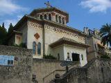
Eglise N.D. du Perpetuel Secour on the way up the "Chem. Tordu du Mont Boron" |
|
|
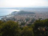
View of Nice from Mt. Boron. The "hill" in the middle is "Le Chateau", the view from which can be seen in my other pictures. The port of Nice is in the foreground. |
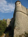
| Fort du Mt. Alban, across a small saddle from Mt. Boron. | |
| The view east from Mt. Alban looking down into Villefranche | |
|
|
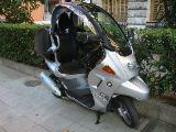
This one is for Hazinski, it is a BMW "executive" motorcycle. Notice the seat belt, leg protection and basically a built in roll bar. |
|
|
Ok, on to the train. |
|
|
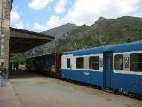
Dropping me off at Tende. |
|
|
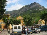
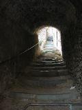
Tende was a little bit touristy, had a good info center and a very nice museum (no pictures) that contained extensive casts of the Neolithic petroglyphs that can be found in the Mont Bego region west of Tende. |
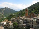
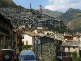
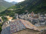
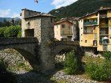
| Tende | |
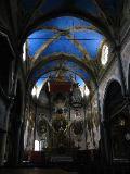
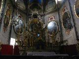
| Interesting church. The outside stone is a local green stone (more later) that reminded me of soapstone. Inside they had done a rather stellar paint job to add features and depth to the ceiling... and what a blue! A feature I can't recall ever having seen before are those...well... "suspended columns" you can see that behind the altar they come down to about five feet and just stop... I couldn't find any indication of how the load was transferred from that point. | |
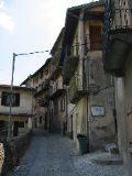
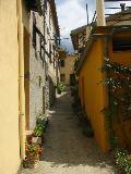
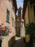
| ...more town | |
|
|
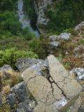
Here is the green stone again, used for stairs... |
|
|
I took a short walk up to a WWI-WWII monument above the town. |
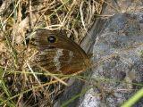
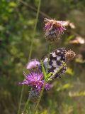
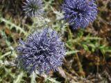
| Managed to get close enough to a couple of butterflies. | |
|
Then I decided to walk up to the cemetery. I really liked the look of the pseudo random tile on the roof. |
|
Kind of playing it fast and loose with the building code? Yes, that is just three slabs of green stone... |
|
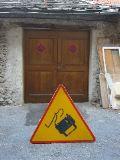
Universal sign for ??? |
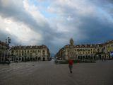
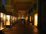
| Ok, on to Cuneo Italy, arrived during heavy rain. Short walk around at night through what seemed a good mile of covered arcade shopping. Nice, but not nice enough to go back. | |
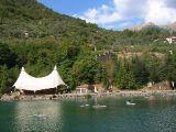
| Next day... dropped off at Breil-sur-Roya. Some kids kayaking here in the damned up Roya. | |
|
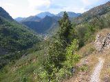
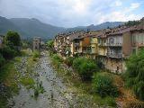
View of the town from the trail south. |
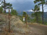
| On the trail... | |
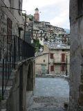
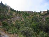
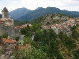
| After about 90 min I approached Piene Haute | |
| Very picturesque little town with some chateau ruins. As I was heading out it started to rain. | |
|
I jumped at a break in the rain only to be confronted with this... oh crap. |
|
Well, about 30 minutes later here I am pretty much on the France/Italy border taking shelter beneath part of an 18th century aquaduct. And yes, I thought of the obvious (but bad) pun involved.... |
|
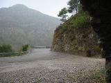
After sitting there for about 45min I decided that the rain had lightened up and headed on... this is an old border marker (the "I" is partially missing)... I don't know the exact history but this area has "swapped sides" many times. Piene Haute was "reunited" with France after WWII by CDG. |
|
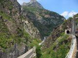
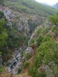
Looking into the gorge approaching Sospel... at this point I was getting really soaked. |
| As I approached Sospel, the sun came out (of course), but that did allow me to dry out. | |
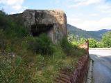
| During WWII, Hitler ignored this sign, bypassed the Maginot line, thus making it simultaneously (arguably) one of the world greatest feats of military engineering and one of the worlds greatest political blunders. | |